
- Home
- Brand
- Control System
- Rail System
- Replica Of
- Alco (4)
- Caboose (6)
- Commodore Vanderbilt (3)
- Diesel Locomotive (7)
- Emd F7 (12)
- Empire State Express (4)
- Freight Car (3)
- Hudson (16)
- N-7 Caboose (3)
- New York Central (32)
- Niagara (4)
- Nyc (3)
- Nyc Hudson (4)
- Pacific (3)
- Passenger Car (14)
- Pullman (20)
- Santa Fe (13)
- Steam Engine (10)
- Steam Locomotive (9)
- Switcher (3)
- Other (3090)
- Scale
- Type
- Box Car (24)
- Caboose (35)
- City Map (6)
- Diesel Locomotive (651)
- Electric Locomotive (78)
- Flat Car (9)
- Freight Car (23)
- Giclee & Iris Print (11)
- Locomotive (181)
- Locomotives (14)
- Pack (9)
- Painting (7)
- Passenger Car (283)
- Passenger Cars (6)
- Photograph (8)
- Print (20)
- Starter Set (31)
- Steam Loco (7)
- Steam Locomotive (832)
- Steam Locomotives (8)
- Other (1020)
New York City Upper & Lower Manhattan Central Park 1851 Hayward lg city plan map
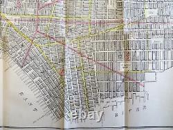
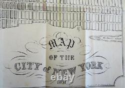
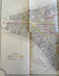
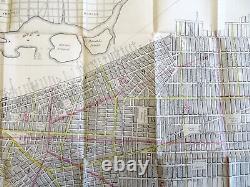
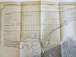
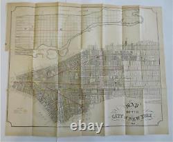


Map of the City of New York. (Old Maps, 19th Century Maps, Americana, United States, New York, Manhattan, New York City, Central Park). Issued 1851, New York by Hayward for Valentine. Large mid 19th century lithographed city plan with original outline hand color. Wards outlined in yellow, fire districts in pink. Original fold lines as issued.
Nice looking example, clean, sheet uniformly age toned, minor age spots. Short closed edge split from inset tab top left corner. 17 1/4" H x 20 3/4" W. Cartographic Reference(s): Tooley's. New York City Upper & Lower Manhattan Central Park 1851 Hayward lg city plan map.

